
Located in the heart of Alberta, Canada—only 35 minutes east of the province’s capital city of Edmonton—Elk Island National Park is a UNESCO-designated Biosphere Reserve. The park is filled with aspen, spruce, and birch forests, lakes, rolling hills, and meadows. It is also home to herds of bison (yes, actual bison), elk, and more than 250 species of birds.
Because this is a National Park, there is a fee to enter. Your National Park Pass (if you have one) will also gain you entry. For updated park entry fees, visit the Parks Canada Website.
The park also has campgrounds, glamping, and backcountry camping available if you want to enjoy a night or two in the wilderness gazing at the stars. Learn more about camping in the park here.
While there are multiple hikes throughout the park, the three that I have selected to feature in this article are open year-round (though in the winter, it is recommended that you use snowshoes or cross-country skis rather than hiking boots!), and I have personally hiked them all at different times of the year.
Lakeview Trail
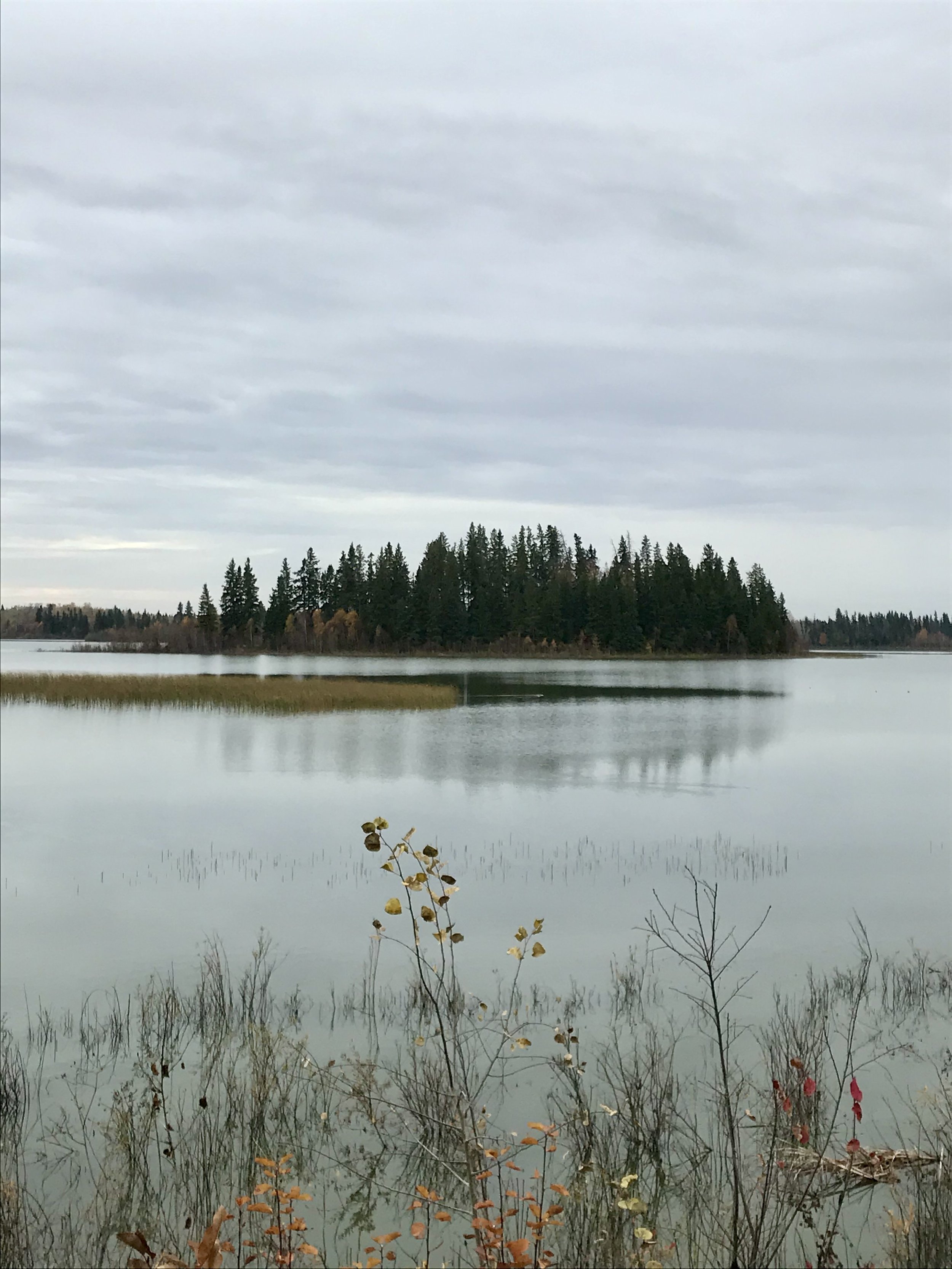
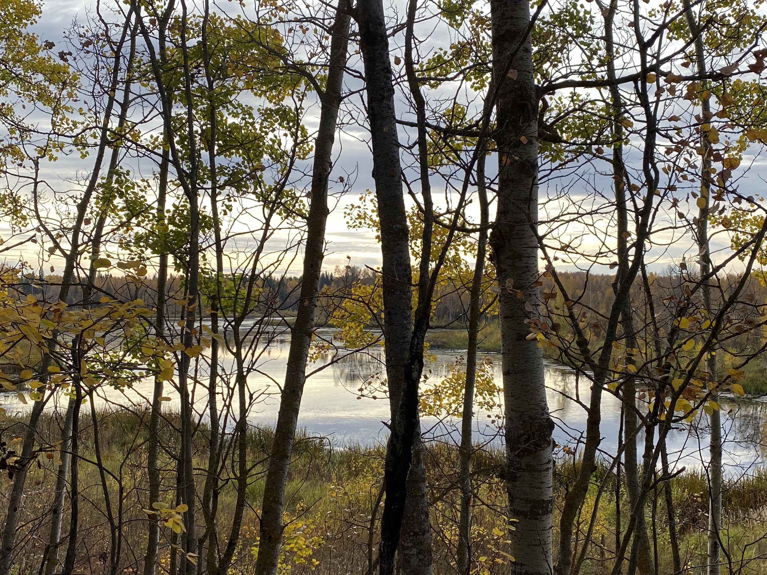
This first trail begins along Astotin Lake. The most visited lake in the park, Astotin has a sandy beach where you can soak up the sun in the summer, lots of fire pits and picnic tables, and a boat launch for your canoes, kayaks, and paddle boards.
The hike begins on a paved trail that leads to a gate. Once through the gate, you find yourself in a thick forest that dips into meadows. If you go left where the path forks, you will get panoramic views of the lake to your left.


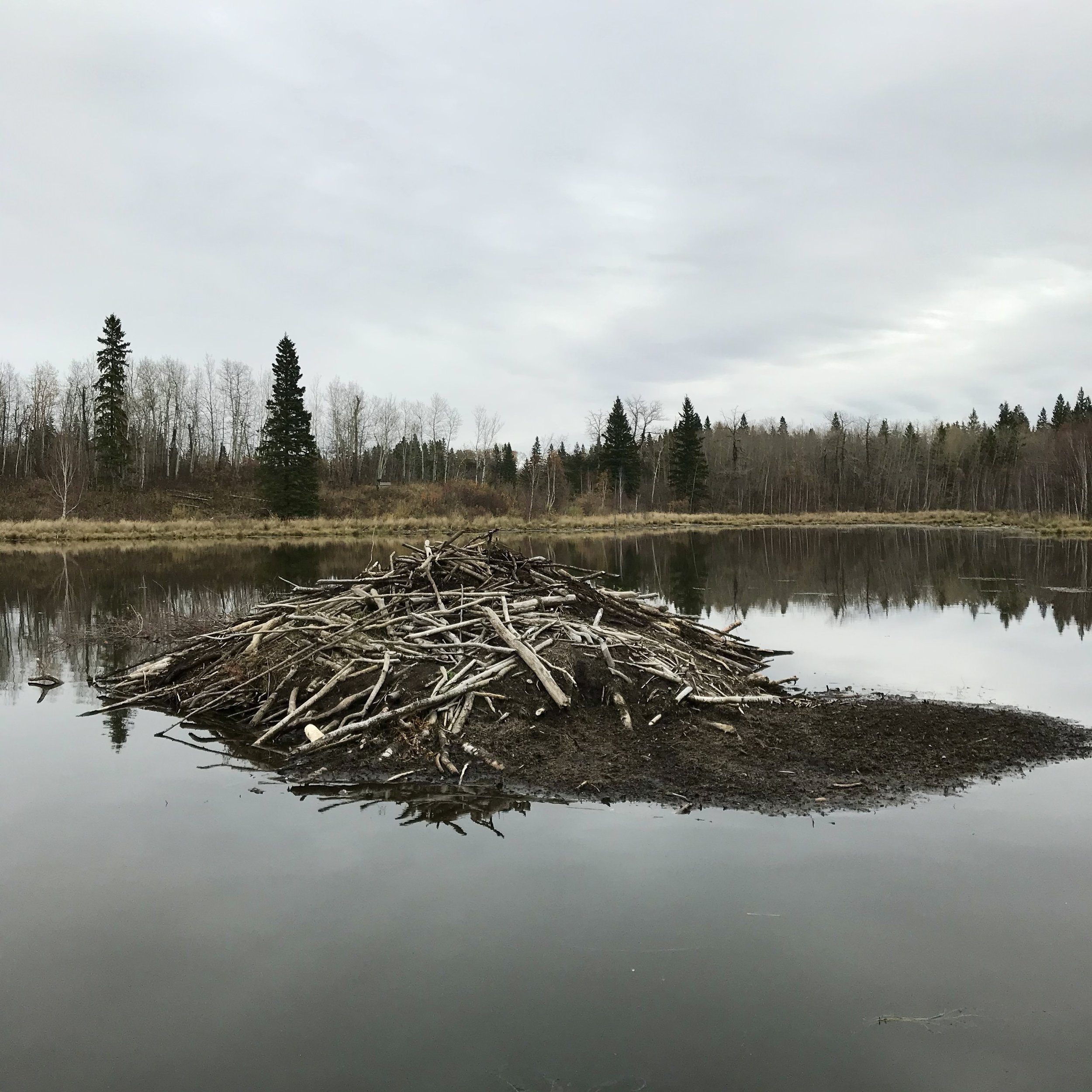
After the curve in the trail, you walk through black spruce bogs and come upon beaver ponds that are filled with lodges and dams. There are wooden benches and viewing platforms where you can watch the beavers in action.
Trail length: 3.7 km (2.3 miles)
Hiking time: 30 minutes to 1.5 hours (depends on how fast you hike, and how many times you pause to look at the view)
Level of Difficulty: Easy
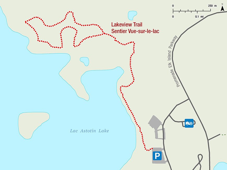
See below for a map of the Lakeview Trail hike sourced from the Parks Canada Website.
Amisk Wuche (Beaver Hills) Trail
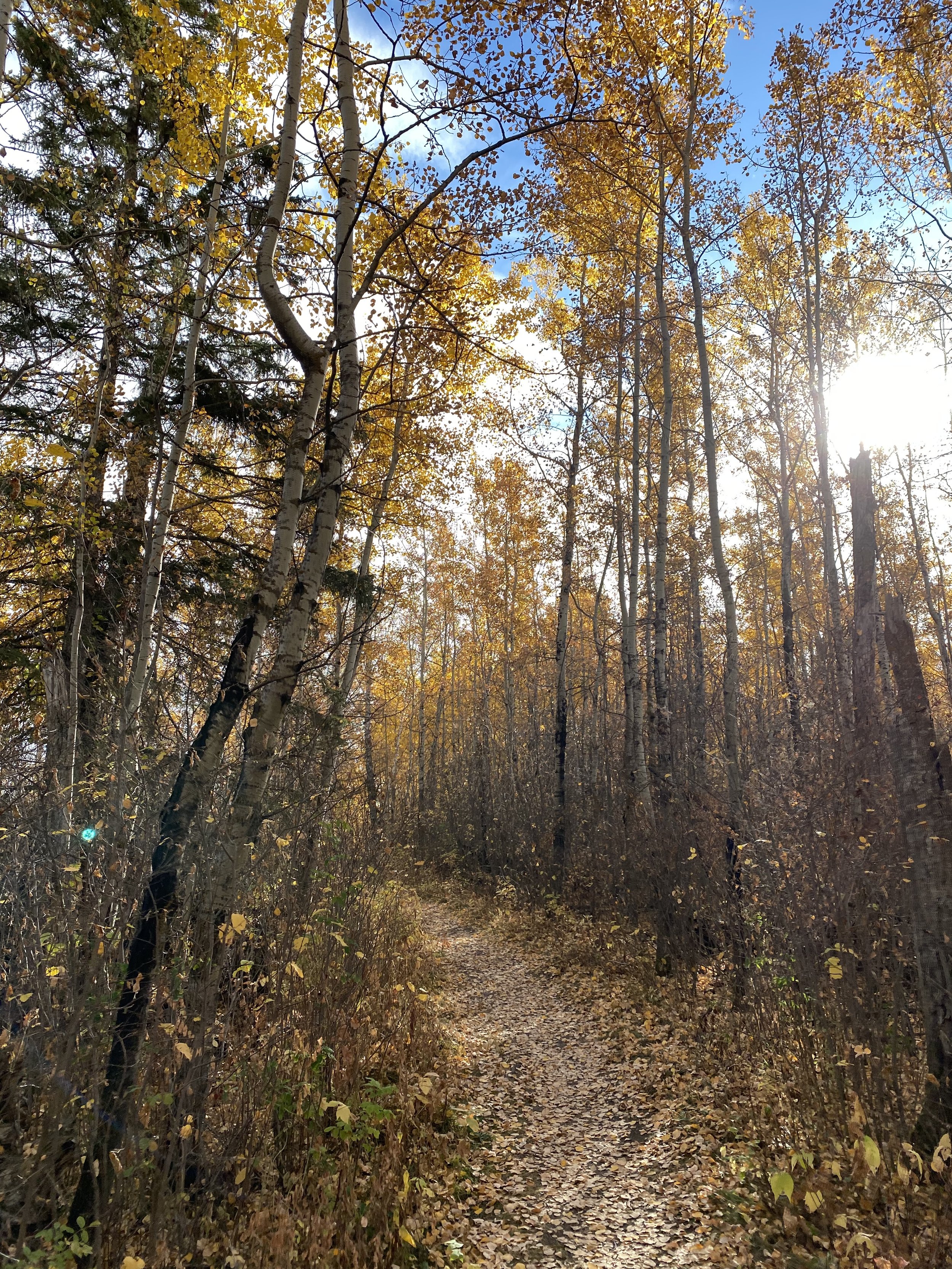
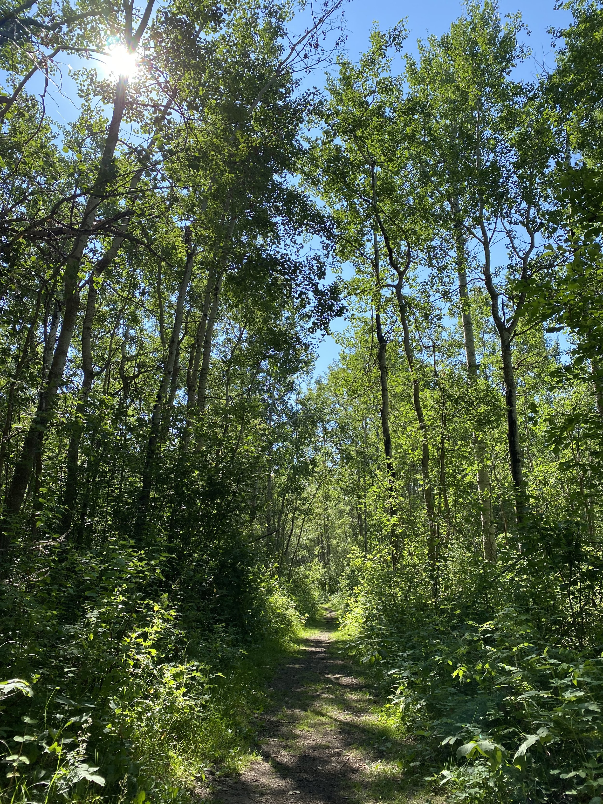
The second trail on the list is called Amisk Wuche, which is the Cree name for Beaver Hills — and that perfectly describes what you will experience on this hike. The trail winds up and down through beautiful forests and grasslands that turn into a cacophony of color in the fall.
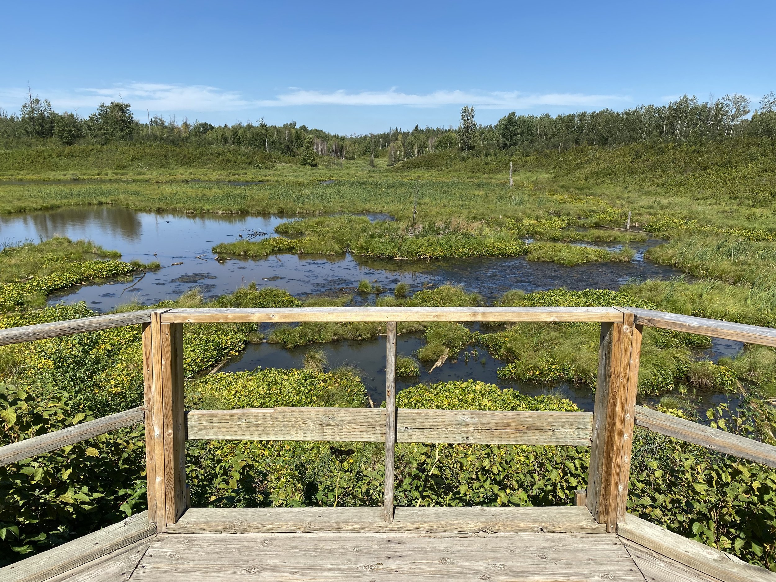
Floating boardwalks take you past ponds, bogs, and over lakes where you can check out the massive beaver lodges — keep your eye out and you will see the homeowners swimming and diving for food!


This trail is my go-to when I want to get in a good sweat in a relatively short period of time and experience a variety of views. I also find walking on the boardwalks over the lakes a ton of fun!
Trail length: 2.7 km (1.7 miles)
Hiking time: 45 minutes to 1.5 hours (depends on how fast you hike!)
Level of Difficulty: Moderate due to the number of hills
See below for a map of the Amisk Wuche hike sourced from the Parks Canada website.

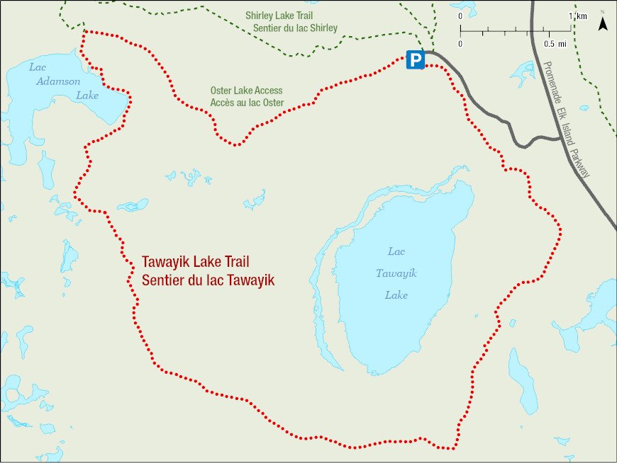
Tawayik Lake Trail
This is the longest of the three hikes that I am recommending and is not for the novice hiker.
You will want to make sure that your backpack is stocked with food, water, extra clothing/layers, bug spray, and sunscreen. It wouldn’t hurt to have a mini first aid kit with you either — just in case.
Because this hike is so long, it is not popular with the average visitor to the park, so you will find yourself quite isolated — especially when you are about halfway into it. It’s important to be prepared for anything.
But trust me, if you are prepared and ready, this 15.1 km hike is well worth the effort.
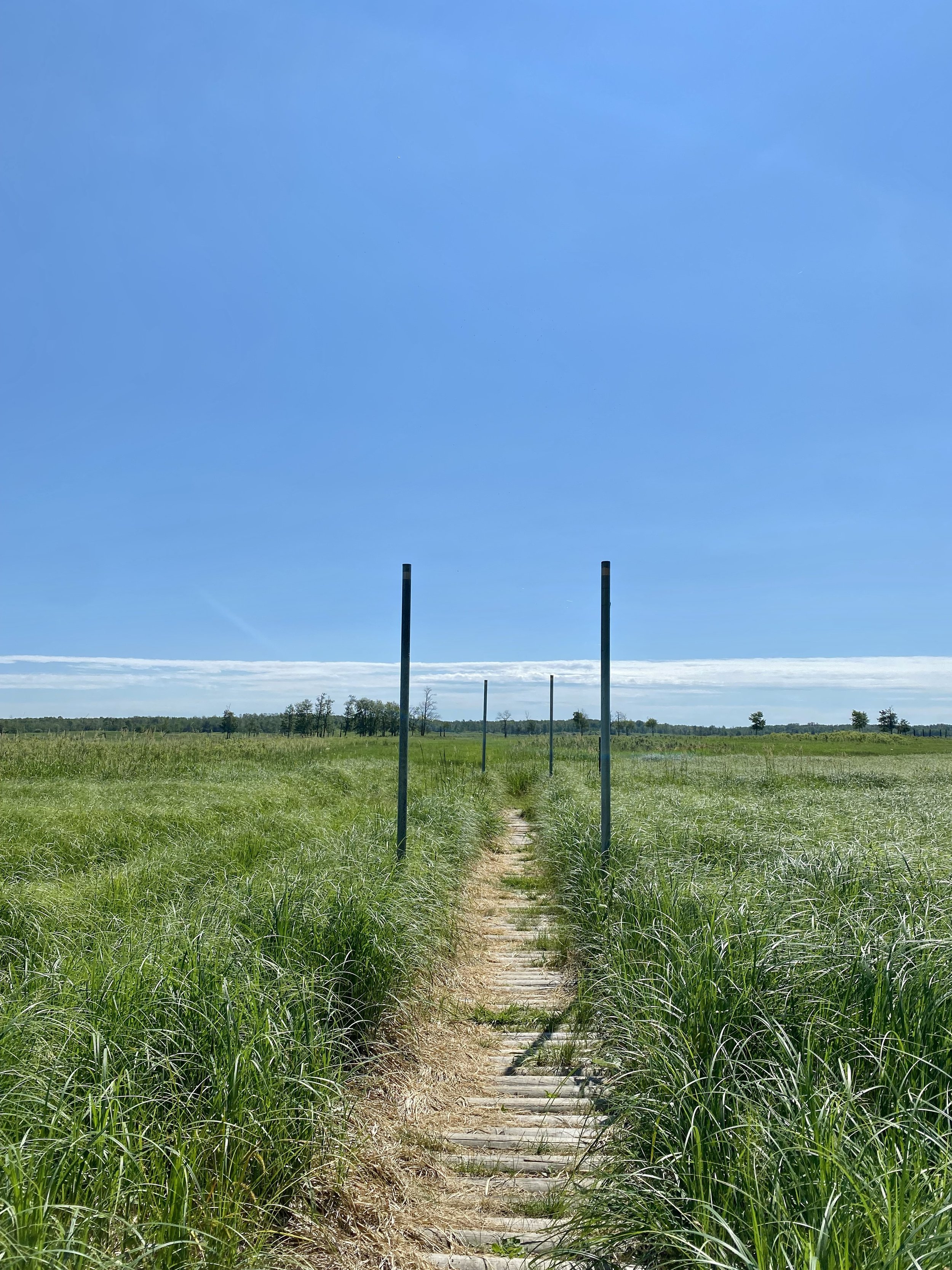
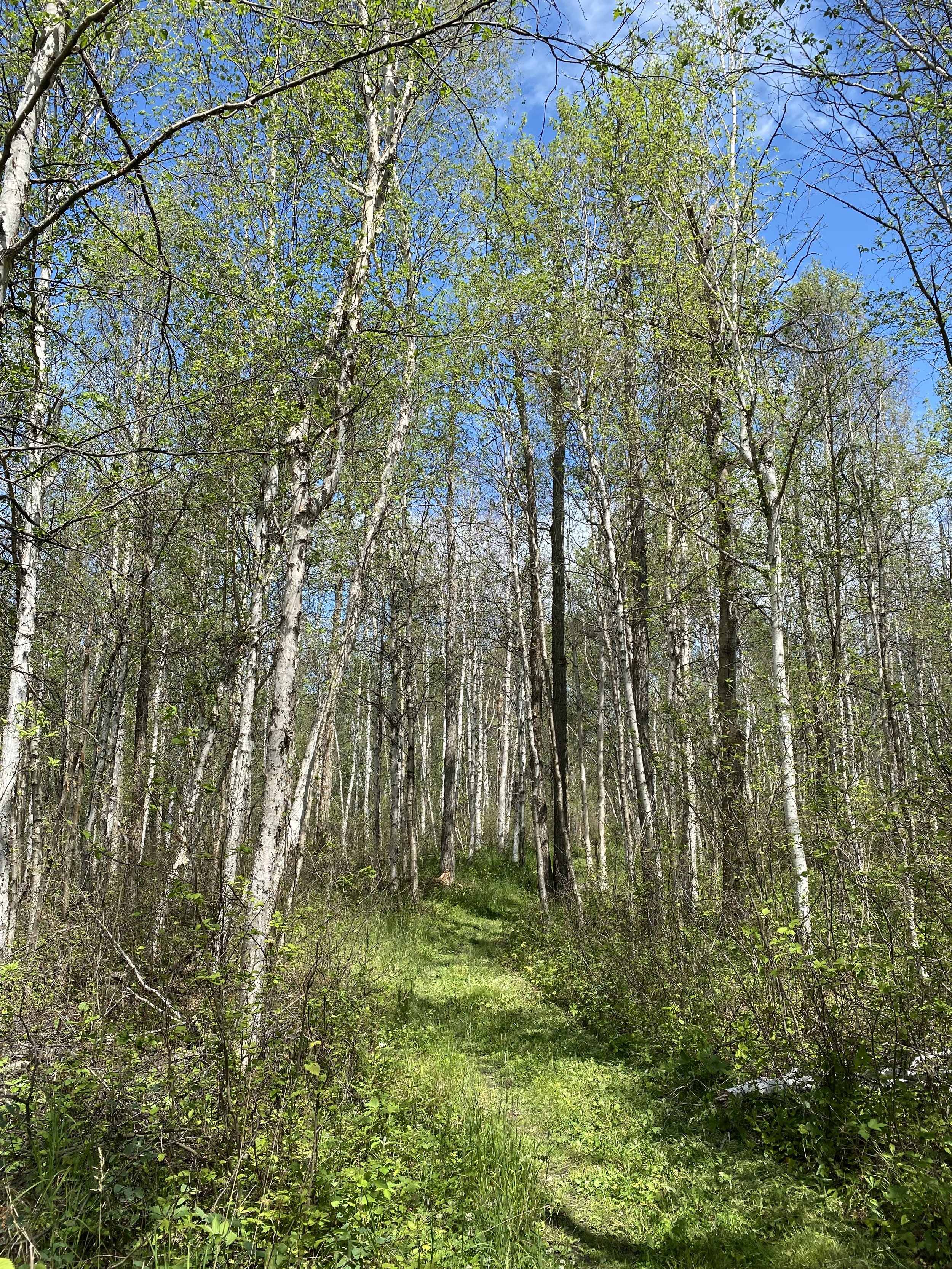
In the summer, the forest is thick and wildflowers grow along the edges of the path attracting butterflies. You will walk up and down hills, through aspen and birch forests, past Tawayik Lake, and into meadows — some with grasses that will come up to your shoulder.
The real show stopper, however, is at the southernmost point of the trail where you come to a vast, open meadow between Tawayik Lake and Little Tawayik Lake. The trail passes straight through this breathtaking landscape, which is also where herds of bison like to graze or lay in the sun.
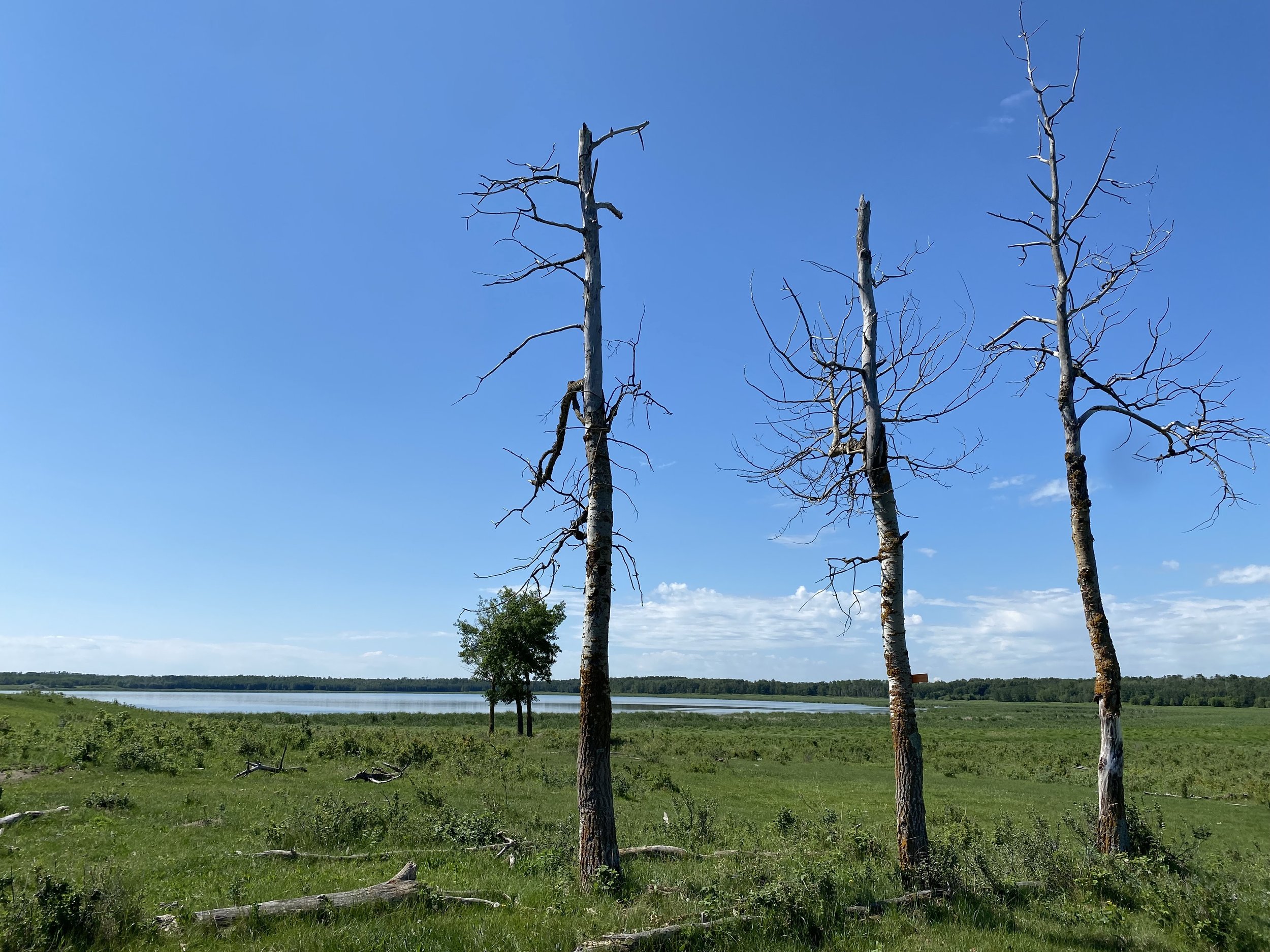
On my most recent hike, I walked alone through this meadow with bison laying only about 100 feet away from me in the grass — it was like something out of a movie!
There are quite a few steep hills along the path, so be prepared for some ups and downs as you make your way through. The hike ends (if you start from the parking lot) on a gravel road through the trees that takes you back to the paved road that leads to the parking lot.
It is a spectacular hike that truly immerses you in the forest and the diverse ecosystems of the park. This hike is also popular with cross-country skiers in the winter.
Trail length: 15.1 km (9.4 miles)
Hiking time: 3 to 5 hours (depends on how fast you hike!)
Level of Difficulty: Difficult due to the length, varied terrain, and number of hills
See below for a map of the Tawayik Lake hike sourced from the Parks Canada website.
Pin Me


Meet The Author
Lindsay Shapka is an avid traveler and the creator of The Anthrotorian — a website dedicated to sharing travel tips, stories about adventures, culture quirks, artists you should know, fascinating bits of history, and more!
She is also an artist, marketing specialist, editor, and freelance writer who has work featured on websites, blogs, and in magazines like National Geographic Traveler.


When I was first asked by some fellow foreigners in South Korea if I wanted to get naked in a public bathhouse and sauna on my first weekend in the country, I looked at them like they were nuts.
Somehow though, they managed to talk me into it (I blame severe jet lag), and it was one of the best decisions that I have ever made.